The Strategic Role of Satellite Imagery in Canada's Arctic Sovereignty and National Security
- Spy Nation PSYOPS

- Dec 13, 2025
- 3 min read
The Arctic is no longer a distant, frozen frontier. It has become a critical region for national security, environmental monitoring, and geopolitical influence. Satellite imagery plays a key role in how Canada monitors and protects its vast northern territories. This article explores how Canada uses space-based intelligence to maintain sovereignty in the Arctic, safeguard critical infrastructure, and respond to emerging challenges in a rapidly changing environment.

Why the Arctic Matters to Canada
Canada’s Arctic region covers nearly 40 percent of the country’s landmass. It includes remote islands, frozen seas, and vast tundra. This area holds strategic importance for several reasons:
Sovereignty: Canada claims sovereignty over the Arctic Archipelago and surrounding waters. Maintaining control over this region is essential to uphold national borders and international law.
Natural Resources: The Arctic contains significant reserves of oil, gas, minerals, and freshwater. Access to these resources could impact Canada’s economy and energy security.
Shipping Routes: Melting ice is opening new maritime passages such as the Northwest Passage. These routes could shorten global shipping times but also require monitoring to ensure safe navigation.
Environmental Protection: The Arctic ecosystem is fragile and vulnerable to climate change. Monitoring environmental changes helps Canada manage conservation efforts and respond to natural disasters.
Given these factors, Canada must maintain a strong presence and situational awareness in the Arctic. Satellite imagery provides a powerful tool to achieve this.
How Satellite Imagery Supports Arctic Sovereignty
Satellite imagery offers a unique vantage point to observe the Arctic’s vast and often inaccessible terrain. Here are key ways Canada uses this technology:
Monitoring Ice Conditions and Climate Change
Satellites equipped with radar and optical sensors track sea ice extent, thickness, and movement. This data helps:
Predict safe navigation windows for ships
Assess the impact of climate change on ice melt patterns
Support scientific research on Arctic ecosystems
For example, the Canadian Ice Service uses satellite data to produce daily ice charts that inform government agencies, shipping companies, and indigenous communities.
Surveillance of Maritime Activity
The Arctic’s growing shipping traffic and potential military activity require constant monitoring. Satellite imagery enables:
Detection of vessels in remote waters
Identification of unauthorized or suspicious activity
Support for search and rescue operations
Canada’s Department of National Defence integrates satellite data with radar and patrol aircraft to maintain situational awareness over the Arctic Ocean.
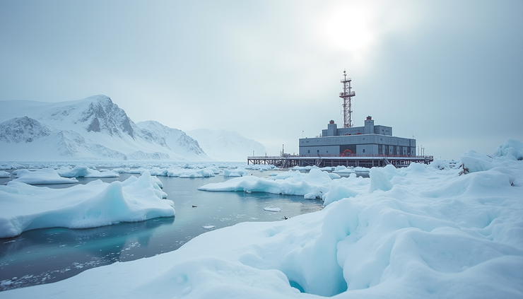
Protecting Critical Infrastructure
Canada’s northern infrastructure includes military bases, communication stations, and resource extraction sites. Satellite imagery helps:
Monitor infrastructure conditions and detect damage
Track construction and development projects
Assess environmental risks such as flooding or erosion
This information supports timely maintenance and security measures in harsh Arctic conditions.
Canada’s Investment in New Satellite Capabilities
Recognizing the Arctic’s growing importance, Canada is investing in advanced satellite technologies tailored for northern surveillance:
RADARSAT Constellation Mission (RCM): Launched in 2019, this series of three satellites provides frequent radar imaging regardless of weather or daylight. It enhances maritime surveillance, disaster management, and ecosystem monitoring.
Enhanced Data Processing: Canada is improving its ability to analyze large volumes of satellite data quickly, using artificial intelligence and machine learning to detect changes and threats.
International Collaboration: Canada partners with allies such as the United States and European countries to share satellite data and improve Arctic coverage.
These investments strengthen Canada’s ability to assert sovereignty and respond to emerging challenges in the North.
The Geopolitical Context of Arctic Surveillance
The Arctic is becoming a stage for global competition. Russia, the United States, China, and other nations are increasing their presence and capabilities in the region. Satellite imagery provides Canada with critical intelligence to:
Track foreign military exercises and infrastructure development
Monitor environmental changes that affect regional stability
Support diplomatic efforts by providing transparent data on Arctic activities
Canada’s use of satellite intelligence helps maintain a balance between asserting national interests and cooperating on shared challenges like climate change and search and rescue.

Challenges and Future Directions
While satellite imagery offers many benefits, Canada faces challenges in fully leveraging this technology:
Data Volume: The sheer amount of data requires advanced processing and storage solutions.
Coverage Gaps: Some remote areas still lack consistent satellite coverage.
Cost: Developing and maintaining satellite systems is expensive.
Integration: Combining satellite data with other intelligence sources remains complex.
To address these issues, Canada is exploring new satellite platforms, investing in ground infrastructure, and enhancing partnerships with indigenous communities who provide valuable local knowledge.